
Geoinformation from Oblique aerial images
- fast and efficient technology for geodata collection
- user frendly system.
- One day training
- Tools for 3D measurement
- detail presentation of structures from different directions
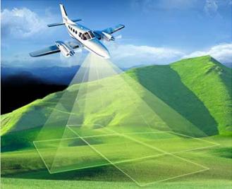
Oblique aerial images are collected by special digital cameras with 5sensors. System provides one vertical and 4 oblique images with 45° vertical angle.
Images have high overlap, so every detail can be seen from at least 12 different directions.
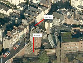 After processing, for each image accurate position and orientation are calculated. Digital terrain model is delivered with images. This technology provides measurement of:
- coordinates,
- 2D and 3D distance,
- area,
- elevation and height
For more info, please download our broshure