

Catalog – Cleaning – Control points – Trajectory adjustment – Delivery
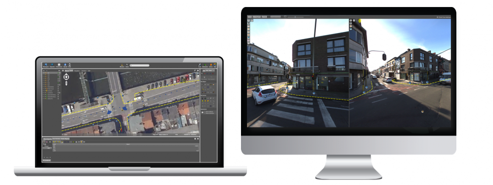
Mobile Mapping catalog
Import, overview, organize, consolidate, deliver, archive
Keep overview of all Mobile Mapping data
View selection in list and on map canvas
Check multiple passes, check positional accuracy
Select to open, process, archive, consolidate, deliver
Clean up
Multiple passes, moving objects, noise
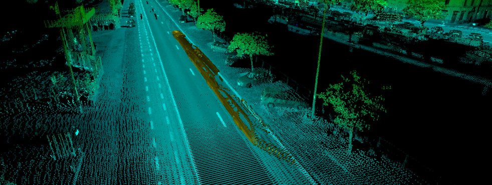
Remove moving objects
remove people
remove unwanted elements
clean up any inconsistancies
consolidate or export point cloud
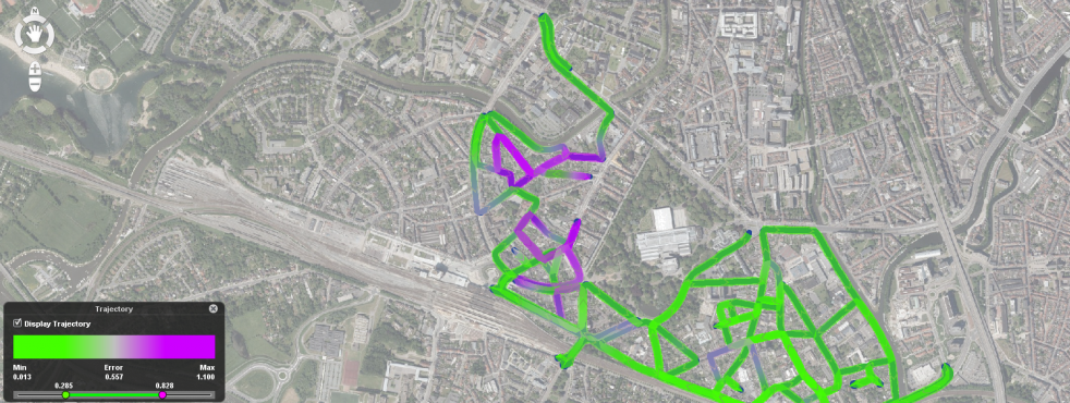
Trajectory adjustment
Correct positional accuracy
Analyse positional accuracy by graph, colorized display on map
select any stretch of the trajectory
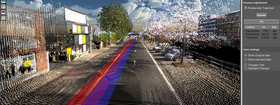
load ground control points and measure constraints
instant preview of trajectory adjustment
process corrections later
adjustment includes point cloud and imagery positions and angles
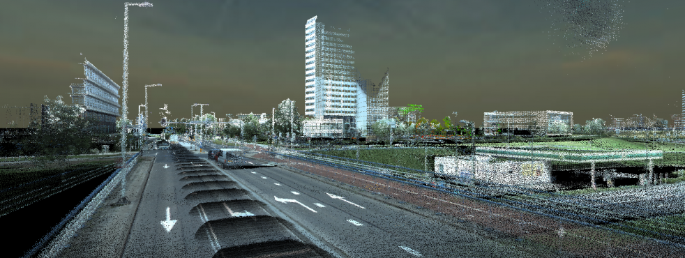
SUPPORTS ALL SYSTEMS
ALL IMAGERY, UNLIMITED POINTCLOUD SIZE
Orbit Mobile Mapping solutions support all mobile mapping systems such as Topcon, Riegl, Trible, Leica, Optech, Cyclomedia, FIS, Trimble, earthmine, LidarUSA and more. It also supports a generic import for panoramic and planar images, and pointclouds with unlimited size.
Import procedures are tuned for each individual vehicle setup, including lever arm corrections, lens calibration, coordinate reference system and more. Templates for vehicle setups can be downloaded.
IMPORT YOUR MOBILE MAPPING DATA
OPTIMIZE MOBILE MAPPING VIEW
Impress yourself: switch your view from 3D to the nearest panorama! Use the anaglyph stereo mode to get a real 3D impression of your pointcloud. And finally, use the isometric mode for a more technical approach.
OPTIMIZE YOUR PROCESSING WORKFLOW
POINT CLOUD COLORISATION
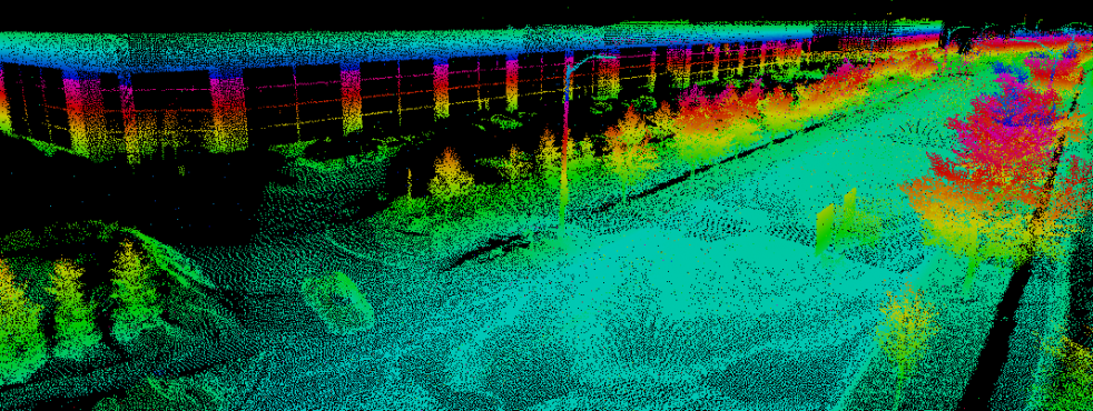
Add Reflection sensibility to each colorisation method.
visible or fixed color range view
pixelsize adjustment, fill point cloud option
transparency slider
view depth slider
(dynamic) thinning options
OVERLAY ALL GEODATA
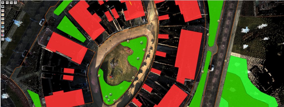
Supports 2D and 3D vector data
Set Transparency, View depth, Height adjustment
WALK THROUGH
Integrated autonomous play/stop functionality to go step by step through your project.
POWERFUL MEASUREMENT TOOLS IN 3D
POINTS, DISTANCES, LINES, AREAS AND MORE
Point cloud measurements as well as measurements based on triangulation are supported. Measurement of position, point drop, distance XY, XYZ, Z, perpendicular distance, distance to reference plane, free polyline, catenary curve, free area, rectangular vertical or horizontal area, squared volumes, etc.
UNCHALLENGED VIEWING
FULLY INTEGRATED IMAGERY AND POINTCLOUD, NO LIMITATIONS
supports fully integrated viewing of imagery, planar and spherical, and pointclouds
hassle free navigation
quick views for top, bird and street viewing angles
jump in and out images
perspective and isometric 3D, view poincloud in anaglyph stereo
supports overlay of vector data in imagery and 3D
powerful pointcloud colorization, selection, clipping, highlighting, export

SUPPORT FOR ALL COORDINATE SYSTEMS
Supports any Geographic, Geocentric and Metric projected coordinate systems.
Supports EPGS library
Supports *.prj file CRS definitions
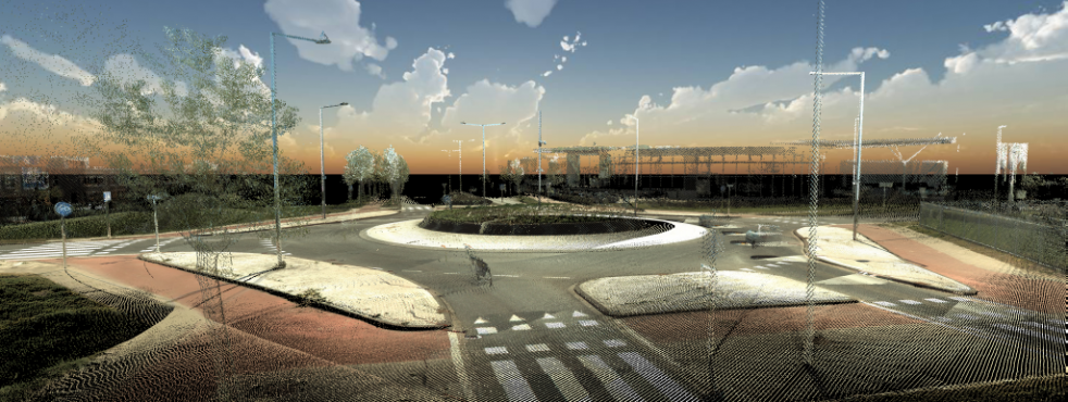
HIGHER THE STANDARDS OF YOUR VIEWS
MAKE AN IMPRESSIVE POINTCLOUD SHOT WITH BACKGROUND
MOVIE MAKER
MAKE OUTSTANDING FLYTHROUGH MOVIES
Impress your client with an outstanding movie of your project!

EXPORT
EXPORT POINT CLOUD TO LAS, LASZIP, E57