
GEOINFO has long experience with Maps and Geodata production. Experience in data capture has been acquired during last two decades, by realization of various projects world wide.
Market of geospatial data is in constant development. We try to meet all customer requirements in this field. This is achieved by continuous learning and investing in modern equipment for collecting and processing of geodata.
For more information on our mapping services, please select following links:
- Aerial mapping
- Mobile Mapping
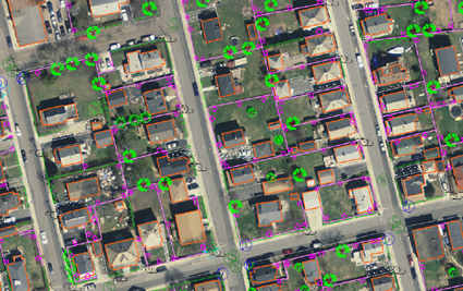
- Digital Vector maps
- 3D City models
- Orthophotos and StereoOrthophotos
- Oblique aerial images
- Digital terrain modells
- Online 3D mapping services – please check our demo